Research and development project · completed
Independo Maps
Making navigation understandable - without relying on text.
Digital maps and navigation apps often assume that people can read and write place names and understand abstract map symbols. Independo Maps explored how maps and navigation could rely more strongly on pictograms, photographs and visual orientation cues.
- Duration
- 2023 - 2025
- Funding
- netidee · Call 18
- Results
- Open-source plugin, prototypes and a documented design process
- Awards
-
- Martin Prager Integration Award
- Content Vienna 2024 · Digital Literacy
When navigation becomes a folder
Digital navigation often feels simple: enter a destination, choose a route and go. But when an application assumes that place names can be read or typed, it creates a barrier.
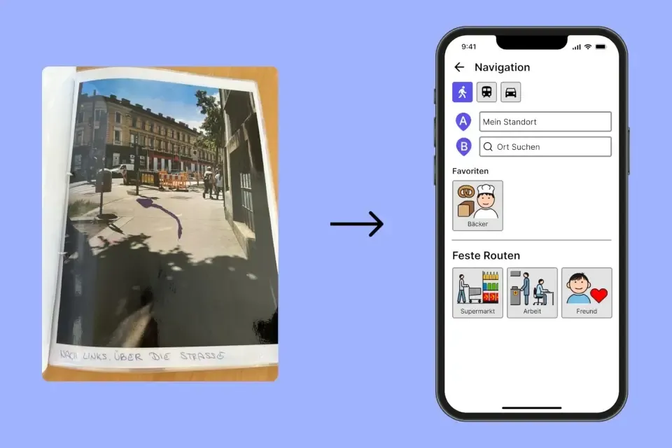
In our research, we encountered very different navigation tools: printed photographs of landmarks, arrows drawn onto those photographs and physical navigation folders prepared for recurring routes.
On our blog: Away with the navigation folder, towards the digital map
Understanding orientation together
-
Step 1
Understand
Together with potential users and partner organisations, we explored how people currently plan and navigate familiar and unfamiliar routes.
-
Step 2
Make barriers visible
Workshops and user journeys helped identify situations where existing map and navigation systems were not understandable or flexible enough.
-
Step 3
Define needs
These observations led to concrete requirements: choosing destinations without text input, receiving visual guidance, recognising landmarks and being able to reach support quickly.
-
Step 4
Develop ideas
Ideation methods and user flows were used to explore and structure different approaches.
-
Step 5
Create prototypes
From early wireframes to detailed visual prototypes, we explored what a more image-based navigation experience could look like.
Approaches to understandable navigation
-
Find places using symbols
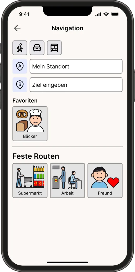
Places and destinations can be made available through pictograms and images rather than relying only on written names.
-
Remember routes visually
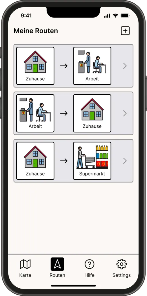
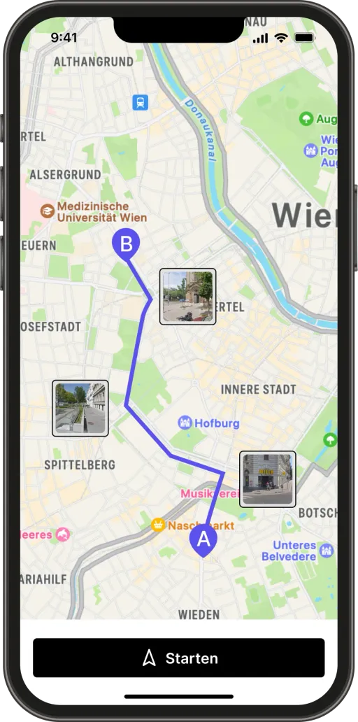
Saved routes can use photographs of familiar landmarks, building on navigation strategies people already use offline.
-
Make directions understandable
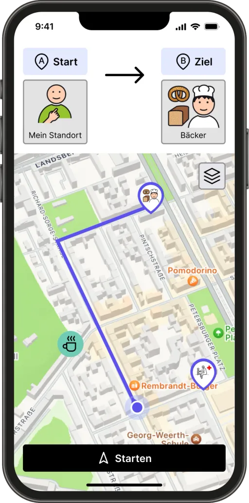
Directions and relevant information can be supported through visual cues rather than relying entirely on text or abstract map information.
-
Reach support quickly
An accessible help function can provide direct access to trusted contacts and prepared ways of asking for support.
The result: an open-source plugin
The netidee project produced Leaflet Independo Maps, an open-source plugin for the Leaflet map library. It enriches digital maps with pictogram-based information and can be used and extended by other software teams in their own applications.
The Independo Maps app concept
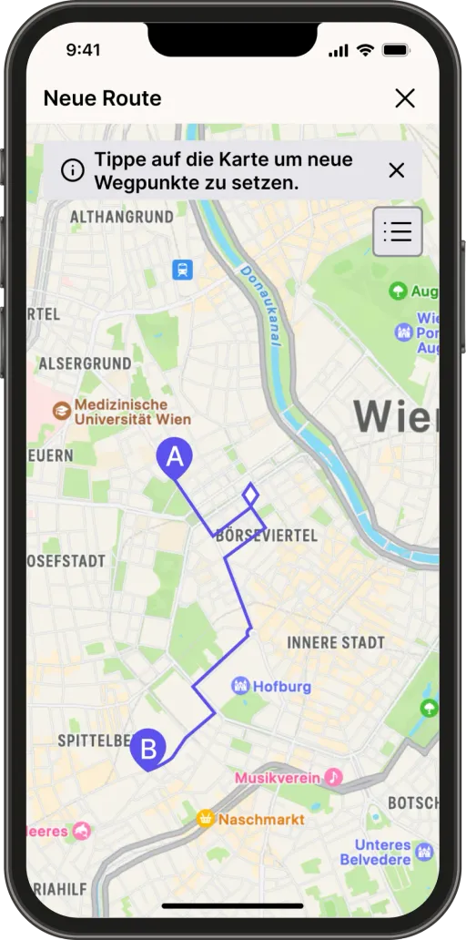
The subsequent design process expanded the question beyond the map plugin. It explored a broader image-based navigation experience including symbol-based destination search, personal locations, visual routes, photographed landmarks, help functions and approaches to mixed-reality navigation.
This produced a concept and an interactive prototype. There is no standalone Independo Maps app: the concept was never built into one, and it is not being pursued at the moment.
What we learned
The project showed that replacing text on a map with pictograms is only one part of the problem.
Orientation also depends on which information matters in a given situation, how a route can be recognised, what level of abstraction works for a person and what happens when support is needed.
This broadened the original technical approach and showed how much more an accessible standalone navigation system would have to address beyond the map itself.
Funded and recognised
-
netidee
Independo Maps was funded as an open-source internet project in netidee Call 18.
-
Martin Prager Integration Award
netidee recognised the project with the Martin Prager Integration Award for its contribution to digital participation.
-
Content Vienna 2024
The wider Independo Maps concept received a special prize in the Digital Literacy focus of the Content Vienna 2024 competition.

Further reading on our blog

Results & resources
The project is complete. Code, documentation, a live demo and the project reports are publicly available.
- Source code on GitHub (opens in a new tab)
The Leaflet plugin with its developer and user documentation, published under the MIT licence.
The prototype screens on this page show Metacom symbols © Annette Kitzinger, metacom-symbole.de. All licence notices
More research at Independo
Every project has its own page, with the question behind it, how we work and what has been published so far.